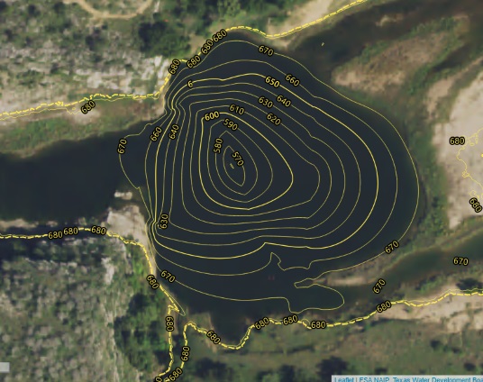
Texas Highland Lake Contours
The Texas Highland Lakes offer beautiful scenery along with some great recreation opportunities. This series of lake contour maps was developed while learning to generate map tiles. The lake contours are viewable on a Leaflet map. Each Highlanf Lake is a layer that can be viewed individually or along with the other lakes. The map tiles were generated using QGIS with the QMetaTiles plugin. All source data was provided by the Texas Water Development Board.
Please note that the Highland Lakes contour maps are general reference and are NOT FOR NAVIGATIONIONAL USE.
Using the Geolocation API
The Geolocation API Specification is a W3C Recommendation that provides access to a device’s geolocation through scripting. The API provides two methods for accessing a device’s geolocation and can be used for data collection that includes positional
information in the form of latitude and longitude. While easy enough to implement, the API can be a bit challenging without a solid understanding of how it works. This article explains some of the less discussed aspects of using
the Geolocation API in an effort toward a better implementation.
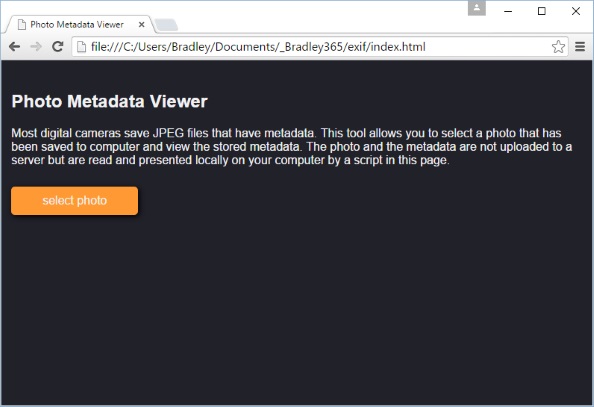
Viewing EXIF Metadata
Most digital cameras save JPEG images with metadata. This tool shows the metadata associated with an image taken with a digital camera. Don't worry, the photo and its metadata are not uploaded to any server. A client-side script does all the work.
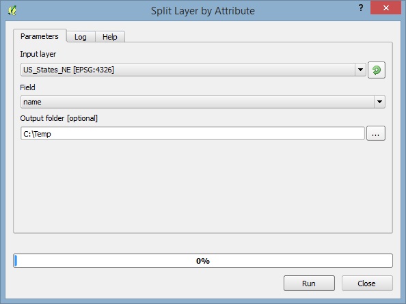
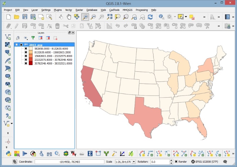
Developing a Split Layer by Attribute Tool
It is somewhat traditional when extracting features from a layer to select features using a selection expression based upon a specific attribute value and save the selected features to a new layer. This example will show one way to automate the
Extract by attribute
tool using the QGIS Processing Framework to develop a custom script that will split a layer using unique values from dialog interface.
The qgis2leaf Plugin
Using Leaflet to make interactive web maps is very straight forward, but what if you don’t have any experience writing html or JavaScript? Well,
you are in luck! There is a qgis2leaf plugin for QGIS from Geolicious. The qgis2leaf plugin can instantly turn your styled QGIS layers into a leaflet map that is ready to post to your website. The plugin creates the html page with the necessary CSS stylesheets and JavaScript files in just a few clicks.
Mapping with Leaflet
Leaflet is an open-source JavaScript library for making web and mobile friendly interactive maps. It offers all the standard mapping abilities you would expect from an web map and being based in JavaScript, Leaflet maps are compatible in most desktop and mobile browsers.
Read More